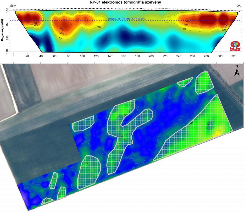
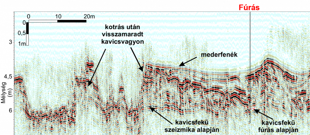
High-precision geophysical survey that can be used efficiently both on land and in water for:
- geological mapping preceding mine opening
- mapping and delineation of barren from mineral of value
- calculation of geological resources
- mapping and calculation of remaining mineral resources in active and abandoned pits